Now Reading: Top 15 Biggest Cities in Nepal by Population: Walk With Me Through Urban Nepal
-
01
Top 15 Biggest Cities in Nepal by Population: Walk With Me Through Urban Nepal
Top 15 Biggest Cities in Nepal by Population: Walk With Me Through Urban Nepal
Explore Nepal's 15 largest cities by population. Walk through ancient temple lanes, lakeside trails, and buzzing Terai bazaars in this traveller's guide.
Close your eyes and picture Nepal. You are probably seeing mountain peaks, right? Snow and ice and prayer flags strung across blue sky. And yes, all of that is here, every breathtaking bit of it. But here is the thing most people don’t expect: Nepal’s cities are just as extraordinary. They are loud and tender, ancient and brand new, full of incense smoke and motorcycle horns and the most incredible food you have ever tasted from a roadside stall.
I have spent a long time wandering through these places, and I want to take you with me. Not just to list the biggest cities in Nepal by population (though we’ll do that too, using the official 2021 National Census), but to walk you into each one. To let you feel what it’s like to step off the bus, look around, and think… okay, this is something special.
So lace up your shoes. We have fifteen cities to explore.
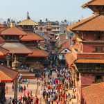
1. Kathmandu: Where Every Alley Has a Secret
Population: 862,400 (metro area approximately 1.7 million) | Area: 49.45 km² | Province: Bagmati
Let me walk you into Kathmandu the way I first experienced it: through the nose. Before you see the city, you smell it. Sandalwood incense curling out of a temple doorway. Fried dough from a sel roti vendor working over a blackened pan. Diesel and dust and, underneath it all, something floral… marigold garlands heaped in baskets on the pavement, their orange so bright it almost hums.
Then your eyes adjust, and Kathmandu opens up in front of you like a pop-up book. Pagoda rooftops layered three, four, five tiers high. Carved wooden windows so intricate they look like lace. A sadhu in orange robes sitting perfectly still beside a fruit seller who’s shouting prices at passing motorbikes. This city has been here for over a thousand years, and every century has left something behind.
Start at Durbar Square, where the old royal palaces and temples cluster together in a kind of controlled chaos. The Kumari Ghar is here, home to Kathmandu’s living goddess, and if your timing is right, you may catch a glimpse of her at the carved window above the courtyard. From there, let the lanes pull you. Thamel is the tourist hub, loud and colourful, stacked with trekking shops and rooftop bars. But step two blocks off the main drag, and you will find yourself in a quiet courtyard where an old woman is drying rice on a mat, and a cat is sleeping in a patch of sun.
Swayambhunath, the “Monkey Temple,” sits on a hill west of the city. Climb the 365 steps (yes, the monkeys are cheeky, guard your sunglasses) and at the top, the entire Kathmandu Valley unfolds below you. On a clear day, the Himalaya lines the northern horizon like a white wall.
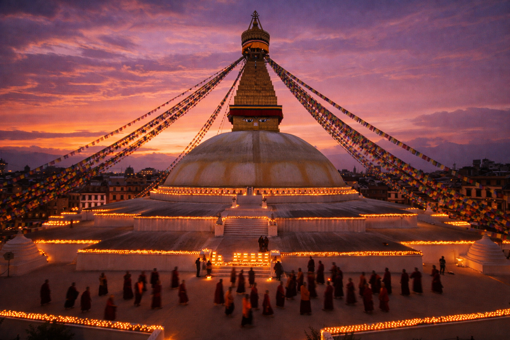
Then there’s Boudhanath, the great white stupa with its all-seeing eyes painted on every side. Come here at dusk. The prayer wheels spin, monks in maroon robes circle the base, butter lamps flicker in the evening air, and the sound of chanting rises from the monasteries that ring the square. Find a rooftop café, order a masala tea, and just sit. You’ll feel something here. Everyone does.
Kathmandu is also the logistical heart of Nepal. Nearly every trek, every tour, every adventure starts or ends in this valley. Tribhuvan International Airport connects you to the world, and from the city’s bus parks, routes fan out to every corner of the country. Budget at least three or four days here, because Kathmandu rewards those who linger.
Where to eat
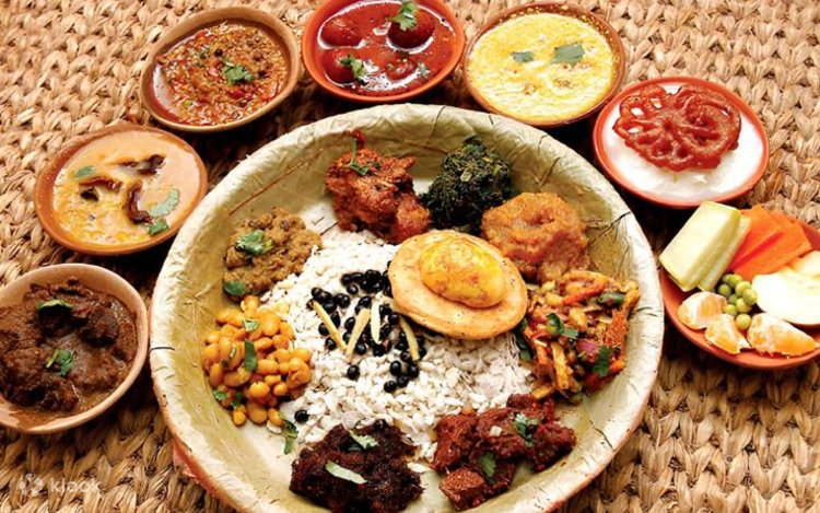
Head to a Newari restaurant in the backstreets of Kirtipur for a traditional feast: beaten rice, marinated meat, black-eyed beans, achar (pickle) that will make your eyes water, and a local rice beer called chhyang that tastes like sour porridge in the best possible way.
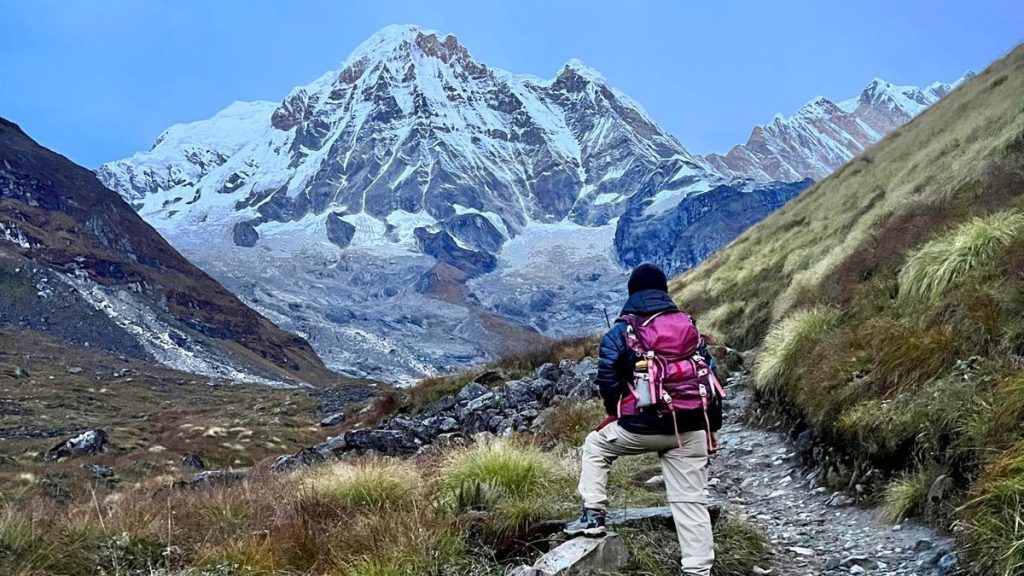
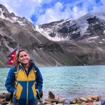
2. Pokhara: Where the Mountains Touch the Water
Population: 513,504 | Area: 464.24 km² | Province: Gandaki
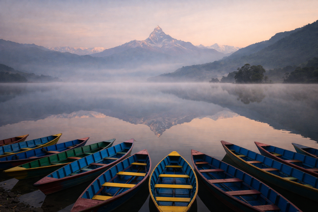
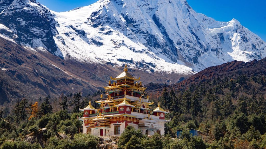
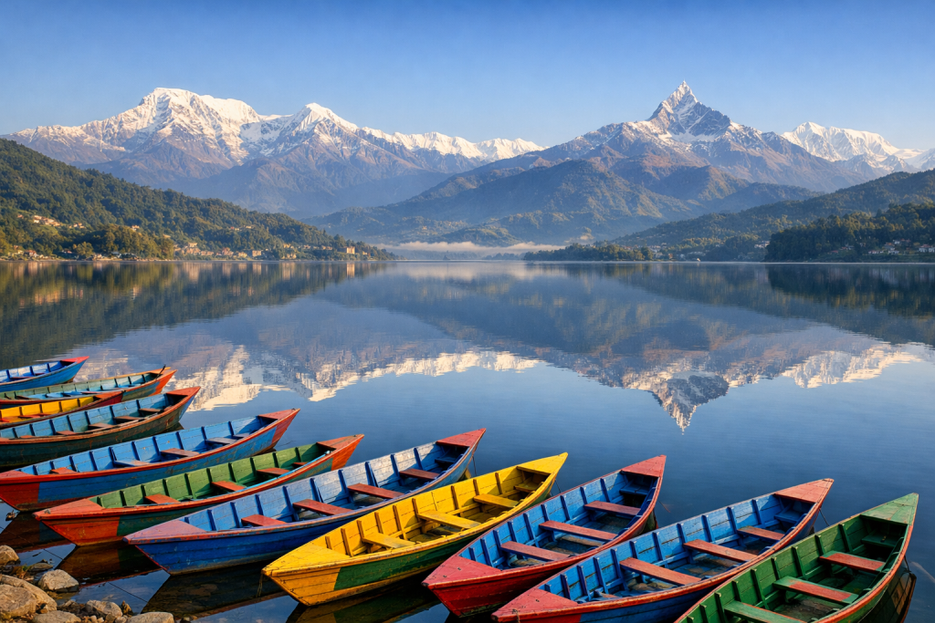
Imagine stepping out of a bus after a winding seven-hour ride from Kathmandu. Your legs are stiff, your ears are ringing, and then… you see it. Phewa Lake, green-blue and glassy, stretching out in front of you with the Annapurna reflected on its surface and Machhapuchhre (the Fishtail) standing like a sentinel above everything. You exhale. Your shoulders drop. Pokhara has that effect on people.
By area, Pokhara is Nepal’s largest metropolitan city, sprawling across more than 464 square kilometres of valleys, gorges, caves, and lakeshores. But it doesn’t feel sprawling. The Lakeside strip, where most travellers base themselves, has a relaxed, almost sleepy energy: colourful wooden boats bobbing at the shore, shops selling singing bowls and Tibetan jewellery, restaurants with cushioned floor seating and views that make you forget to look at the menu.
But don’t let the calm fool you. Pokhara is Nepal’s adventure capital. Paragliding here is world-class; you launch from Sarangkot ridge and spiral over the lake with the Annapurna range filling your entire field of vision. There’s zip-lining across the Seti Gorge, ultralight flights that take you within arm’s reach (or so it feels) of the peaks, kayaking on the lake, and bungee jumping for those who want their adrenaline served neat.
And of course, Pokhara is the gateway to some of the planet’s most iconic treks. The Annapurna Circuit, Annapurna Base Camp, Mardi Himal, Poon Hill all start from here. Trekking permit offices, gear rental shops, and porters-for-hire are everywhere. Even if you are not trekking, you can drive or take a short hike to viewpoints like Sarangkot or the World Peace Pagoda and see the Himalaya without breaking a sweat.
For a quieter afternoon, rent a boat and row to the little island temple in the middle of Phewa Lake. Or explore Devi’s Fall, where the Pardi Khola stream vanishes underground into a terrifying hole in the rock. Just across the road, Gupteshwor Mahadev Cave takes you underground to see where the water re-emerges, passing stalactites and a subterranean Shiva shrine along the way.
Where to eat
Lakeside is packed with restaurants serving everything from Nepali thali to Turkish hummus to Korean bibimbap (the trekking crowd is international). But for something truly local, cross to the old bazaar side of town and find a bhatti (local eatery) serving dal bhat with a dozen little side dishes: pickles, greens, lentil soup, and crispy papadum. Refills are unlimited. You will not leave hungry.
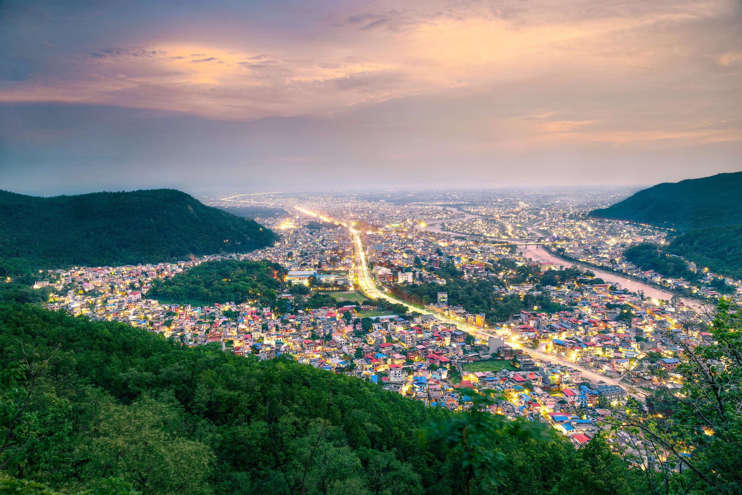
3. Bharatpur: The Jungle Wakes Up Around You
Population: 369,268 | Area: 432.95 km² | Province: Bagmati
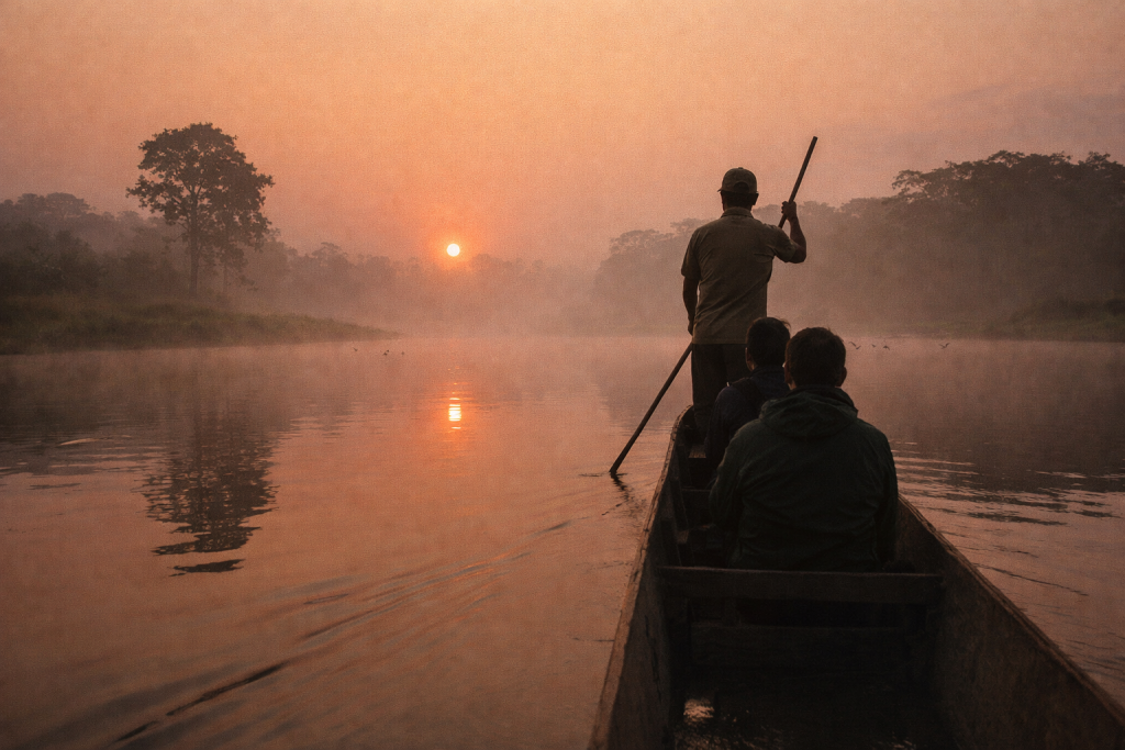
Walk with me into Bharatpur in the early morning, when the fog hasn’t quite lifted and the air is thick, warm, subtropical. You can hear birds you’ve never heard before: strange calls from the sal forest that borders the southern edge of the city. A kingfisher flashes electric blue across the Narayani River. Somewhere in the distance, an elephant rumbles. This is Bharatpur, and the jungle is never far away.
Nepal’s third-largest city by population, Bharatpur is the main gateway to Chitwan National Park, one of Asia’s premier wildlife reserves and a UNESCO World Heritage Site. The park is home to one-horned rhinoceros, Bengal tigers, sloth bears, gharial crocodiles, and over 500 species of birds. Jeep safaris, canoe rides along the Rapti River, guided jungle walks, and elephant breeding centres are all within easy reach of the city.
But Bharatpur is more than just a launchpad. The city itself has a youthful energy: it’s a regional centre for education and healthcare, with universities, medical colleges, and a growing commercial district. The Narayani riverbank is where locals come to walk in the evenings, and the surrounding farmland is some of the most fertile in Nepal, producing rice, mustard, and lentils that feed much of the country.
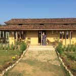
What I love most about Bharatpur is the cultural layer. The Tharu people, the indigenous community of the Terai lowlands, have lived in this region for centuries. Visit a Tharu village on the outskirts of Chitwan and you’ll find longhouses with beautifully painted mud walls, communal fish ponds, and a tradition of stick dancing that’s as rhythmic and hypnotic as anything you’ll see in Nepal. If you’re lucky enough to be invited to eat, expect freshly caught river fish, snail curry, and rice served on a leaf plate.
Don’t miss
A dawn canoe ride on the Rapti River. The water is like glass, the mist is thick enough to taste, and the birdlife is dazzling: painted storks, fish eagles, and if you stay very quiet, you might see a rhino come down to the riverbank to drink.
4. Lalitpur (Patan): Art Carved Into Every Stone
Population: 294,098 | Area: 36.12 km² | Province: Bagmati
Cross the Bagmati River from Kathmandu and step into Lalitpur, and the city shifts. The pace softens. The streets narrow. And everywhere you look, there is art. Not in galleries (though those exist too), but in the fabric of the buildings themselves: intricate woodcarvings on window frames, stone sculptures tucked into courtyard walls, metalwork so fine it looks like frozen lace.
Lalitpur, still lovingly called Patan by almost everyone, is the smallest of Nepal’s six metropolitan cities by area, just 36 square kilometres. But what it lacks in size, it makes up for in sheer cultural density. This is a city where artisan families have been practising the same crafts, metalcasting, stone carving, woodwork, thangka painting, for forty or fifty generations. Walk through the backstreets and you’ll hear the tap-tap-tap of a copper repoussé artist shaping a Buddha figure by hand, or catch the sharp scent of lacquer drying on a freshly carved temple strut.
Patan Durbar Square is the jewel. Many people say it’s the most beautiful of the Kathmandu Valley’s three royal squares, and I won’t argue. The Krishna Mandir, carved entirely from stone, stands at one end; the old royal palace, now home to the extraordinary Patan Museum, anchors the other. Between them, pagoda temples and columned shrines cluster together in an arrangement that somehow feels both random and perfectly composed.
Wander beyond the square and you’ll discover the bahals, the hidden monastery courtyards that dot the old city. Push open an unmarked wooden door and you might find a 14th-century chaitya (miniature stupa) surrounded by potted plants, laundry lines, and playing children. These courtyards are still functioning community spaces, and they’re one of Patan’s greatest charms.
Where to eat
Patan is the undisputed capital of Newari cuisine. Find a traditional Newari bhoj (feast) restaurant and settle in for beaten rice with spiced buffalo, black soybeans, fried fish, fermented greens, and enough varieties of achar to make your head spin. Wash it all down with aila, the local Newari rice spirit. It’s strong. You’ve been warned.
5. Birgunj: The Roar of Commerce at the Border
Population: 272,382 | Area: 132.07 km² | Province: Madhesh
Step into Birgunj and you step into a different Nepal entirely. This is the Terai at its most visceral: flat, hot, loud, and unapologetically commercial. Trucks queue for kilometres at the Birgunj-Raxaul border crossing, the single busiest trade point between Nepal and India. The air smells of diesel, cardamom, and frying oil. Rickshaws weave between lorries. Markets spill off the pavements and into the road itself.
Birgunj handles a staggering volume of Nepal’s overland trade, and the city pulses with that energy. The Ghantaghar (clock tower) area is the old heart of town: narrow lanes crammed with fabric shops, jewellers, spice merchants, and sweet stalls where mountains of orange jalebi glisten under glass cases. The Maithili, Bhojpuri, and Hindi-speaking communities that call Birgunj home give it a cultural flavour that’s far more connected to the Indian Gangetic plain than to the Kathmandu hills.
For travellers, Birgunj offers something rare: a completely unvarnished look at working Nepal. There’s no tourist polish here, no trekking shops or banana-pancake cafés. What there is, however, is extraordinary street food (samosas, chaat, thick spiced chai, and the crispiest dosas you’ll find outside of Tamil Nadu), a fascinating industrial heritage, and the chance to see the economic engine that keeps Nepal running.
Don’t miss
The Birgunj Parsa Industrial Corridor, which sounds dry but is genuinely interesting if you want to understand Nepal’s economy. And if you’re a food lover, walk the Ghantaghar bazaar at dusk when the sweet shops fire up and the air turns sugary.
6. Biratnagar: The East Wakes Up Early
Population: 243,927 | Area: 77.00 km² | Province: Koshi
Biratnagar wakes up early. By six in the morning, the tea stalls along the main road are already crowded, bicycle rickshaws are navigating the foggy streets, and the jute mills on the city’s outskirts are humming. This is Nepal’s industrial capital, the largest city in the eastern Terai, and a place where real, unglamorous, everyday Nepali life is on full display.
Founded as a planned industrial town in the 1930s, Biratnagar has a history tied to Nepal’s independence movement: the 1951 revolution that ended the autocratic Rana regime was partly sparked here. Today, the city is the economic engine of eastern Nepal, with manufacturing, trade, and education anchoring a population that’s growing fast.
For travellers, Biratnagar is most useful as a transit hub. Flights to Kathmandu take about 40 minutes, and the city is the closest major centre to Koshi Tappu Wildlife Reserve, a wetland sanctuary famous for its wild water buffalo, migratory birds, and Gangetic dolphins. The border crossing to Jogbani in India is just south of the city.
But if you have a day to spare, Biratnagar is worth exploring on its own terms. The bazaar areas have a South Asian bazaar energy that’s infectious: spice mountains in burlap sacks, sari shops blazing with colour, and street food vendors frying up bara (lentil patties) and chatpate (a tangy, crunchy snack mix that’s addictive).
7. Ghorahi: The Wide Open Heart of Dang Valley
Population: 200,530 | Area: 522.21 km² | Province: Lumbini
Now walk with me somewhere most tourists never go. Ghorahi sits in the Dang Valley, a broad, fertile inner Terai basin in western Nepal, cradled between the Mahabharat range to the north and the Chure Hills to the south. The valley floor stretches wide and green, rice paddies shimmering in the heat, and the sky feels enormous here in a way you don’t experience in the cramped mountain valleys.
Here’s a fact that surprises people: Ghorahi is the largest city in Nepal by area, covering more than 522 square kilometres. It’s a sub-metropolitan city, meaning it hasn’t hit the 500,000 population threshold for metropolitan status, but its physical footprint dwarfs Kathmandu many times over.
The Dang Valley has been home to the Tharu people for centuries, and their cultural presence is strong. Longhouses with thick mud walls and thatched roofs dot the countryside. During Maghi, the Tharu New Year celebrated in January, the valley explodes with colour: stick dances, peacock dances, feasting, and a communal spirit that makes you feel instantly welcome even as a stranger.
Ghorahi is also a growing educational and commercial hub for the mid-western region. The weekly haat bazaar (open-air market) brings farmers from surrounding villages to trade vegetables, livestock, and handwoven textiles. It’s chaotic, loud, and completely wonderful.
Don’t miss
A walk through the Dang Valley at sunset, when the light turns gold and the distant hills go purple. Visit a Tharu homestead if you can; the hospitality is legendary, and you’ll likely be offered dhikri (steamed rice bread) and fresh-picked vegetables cooked over a wood fire.
8. Dhangadhi: The Far West Welcomes You
Population: 198,792 | Area: 261.75 km² | Province: Sudurpashchim
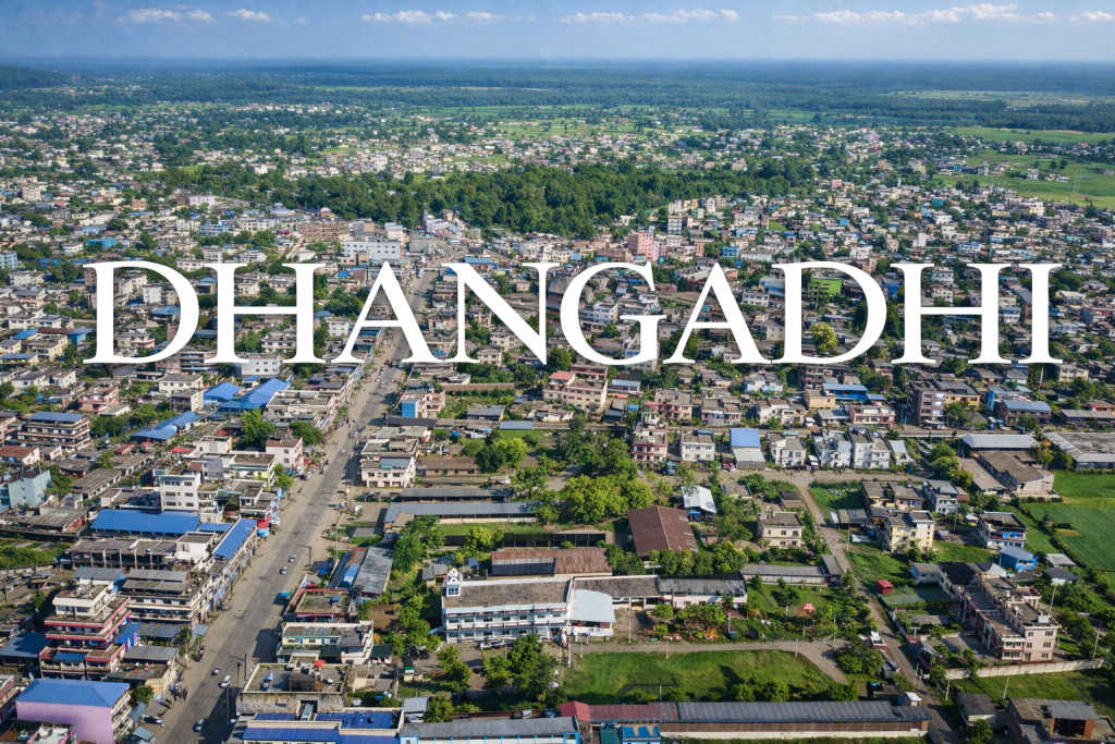
Getting to Dhangadhi takes commitment, and that’s part of its charm. This is Nepal’s far west, the Sudurpashchim Province, a region that most tourists overlook entirely. But those who make the journey discover something special: a city on the edge of genuine wilderness, surrounded by some of Nepal’s least-visited and most rewarding natural landscapes.
Dhangadhi itself is a bustling Terai town with wide streets, a growing university district, and markets that serve as the commercial hub for the entire far-western region. The Mohana River runs nearby, and the flat agricultural land stretching south toward the Indian border produces rice, sugarcane, and lentils.
But the real draw is what lies beyond the city limits. Shuklaphanta National Park, about an hour’s drive to the southwest, is one of Nepal’s hidden gems: grasslands that stretch to the horizon, herds of swamp deer (the largest concentration in Asia), wild elephants, Bengal tigers, and a birdlife that will have you burning through camera memory cards. Further north, the remote Api Nampa Conservation Area offers high-altitude trekking in a region so quiet you might not see another tourist for days.
The Tharu cultural presence is deep here too. Dhangadhi is one of the best places in Nepal to experience authentic Tharu village life: homestays where you sleep on a woven mat under mosquito nets, eat fish curry with your hands, and fall asleep to the sound of crickets and distant drums.
9. Itahari: The Crossroads That Became a City
Population: 197,241 | Area: 93.78 km² | Province: Koshi
Twenty years ago, Itahari was a small junction town on the Mahendra Highway in eastern Nepal. Today, it’s one of the fastest-growing cities in the country, a sub-metropolitan centre with a population pushing 200,000 and an energy that crackles through its bazaars, tea shops, and newly built housing blocks.
What happened? Geography. Itahari sits at the crossroads of the east-west Mahendra Highway and the north-south road that climbs to Dharan and beyond into the eastern hills. Every bus, truck, and traveller heading through eastern Nepal passes through this junction, and the city has grown up around that traffic like a tree around a fence post.
For travellers, Itahari is a gateway to Nepal’s eastern treasures. Head north to Dharan and the hills beyond, and you’re on your way to the Kanchenjunga base camp trek, one of Nepal’s most remote and spectacular. Head east, and you’ll reach Ilam, Nepal’s tea-growing region, where terraced green hillsides look like they’ve been borrowed from Darjeeling and the chai is some of the best you’ll ever taste.
But pause in Itahari itself and explore the food. The city sits in a cultural crossroads between the Limbu, Rai, and Madheshi communities, and the cuisine reflects that diversity. Try kinema, a fermented soybean preparation that’s pungent and earthy. Try tongba, warm millet beer served in a traditional brass pot and sipped through a bamboo straw; it warms you from the inside on cool evenings. Try sel roti fresh off the griddle, its edges crispy and its centre soft and sweet.
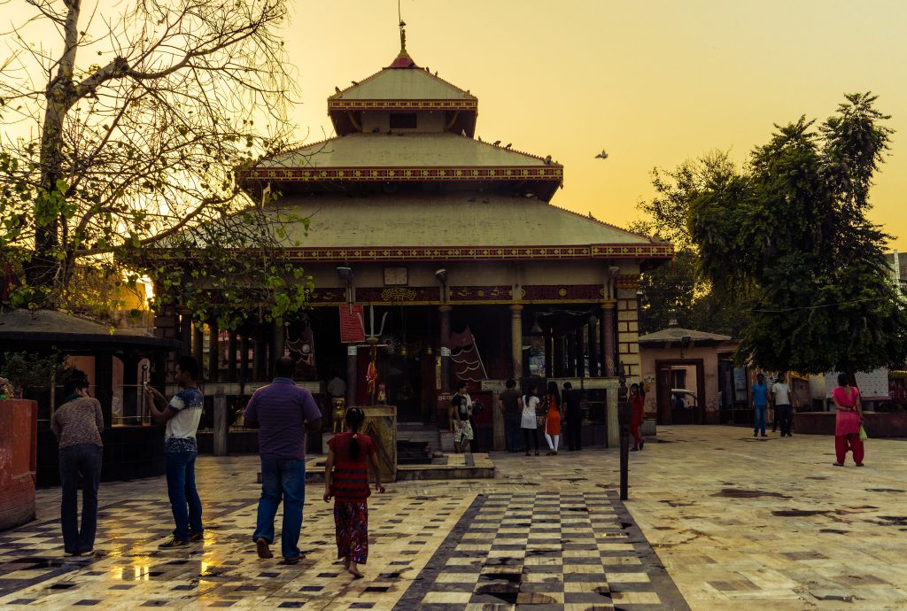
10. Janakpur: Walk Into a Living Epic
Population: 194,556 | Area: 91.97 km² | Province: Madhesh
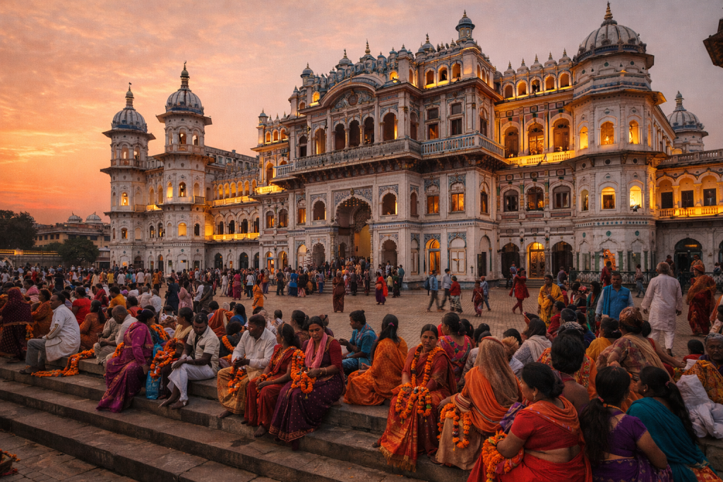
Let me take you to a city where mythology isn’t something in a book; it’s the air you breathe, the buildings you walk through, the songs you hear drifting from every temple door. Janakpur, according to Hindu tradition, is the birthplace of Sita, the most important character of the Ramayana, and the place where she married Lord Ram. For millions of devotees, this is sacred ground.
The Janaki Mandir is the city’s crown jewel: a grand, gleaming white marble temple built in the Mughal-Rajput architectural style, with arched windows, delicate lattice screens, and domes that catch the light. Step inside during evening aarti (prayer ceremony) and the sensory experience is overwhelming: bells ringing, incense billowing, flowers strewn across the marble floor, and hundreds of voices chanting in unison.
But Janakpur’s magic extends well beyond the main temple. The city is dotted with sacred ponds, each with its own mythology and its own community of worshippers. Cycle rickshaws are the best way to explore; hire one for a few hours and let the driver take you on a loop through the old town, stopping at Dhanush Sagar, Ganga Sagar, and the dozens of smaller shrines hidden in residential neighbourhoods.
And then there’s the art. Janakpur is the heartland of Mithila culture, and the women here have practised Mithila painting for generations: bold, geometric, vibrantly coloured works on paper and walls that depict gods, animals, nature, and scenes of daily life. Visit the Janakpur Women’s Development Centre to watch artists at work and pick up original pieces. These aren’t mass-produced souvenirs; they’re genuine works of art with deep cultural roots.
Don’t miss
If you visit during Vivah Panchami (usually in November or December), you’ll witness the re-enactment of Sita and Ram’s wedding: a citywide celebration with processions, music, feasting, and a emotion that turns Janakpur into one of the most electrifying places on Earth.
11. Butwal: Where the Hills Meet the Plains
Population: 194,335 | Area: 101.61 km² | Province: Lumbini

Picture this: you’re driving south from the hills, the road winding down through forest, and then the landscape opens up and flattens out in front of you. That transition point, where the foothills of the Mahabharat range tumble into the flat Terai, is where Butwal sits. It’s a city defined by geography, a place where two Nepals meet.
Butwal is one of Nepal’s most important transport and commercial hubs, a connector city linking the Kathmandu-to-Sunauli highway (the main route to the Indian border at Bhairahawa) with roads heading west to Palpa, Dang, and beyond. The city’s bazaars are always busy: fabric merchants, electronics shops, produce vendors hauling baskets of oranges and bananas in from the surrounding farmland.
But what makes Butwal special for travellers is its position as a launchpad. Lumbini, the birthplace of the Buddha and a UNESCO World Heritage Site, is just over an hour south. The hilltop town of Tansen (Palpa), with its Newari architecture, panoramic views, and hand-beaten metalwork tradition, is about 90 minutes north. And the Siddha Baba Temple, perched in the hills above the city, offers a stunning viewpoint where you can see the entire Terai stretching south to the Indian horizon.
In the city itself, the Tinau River cuts through the centre, and the riverside walk at sunset is a local favourite. Street food stalls cluster near the bus park, and the momos here, both steamed and fried, are honest and satisfying after a long day of travel.
12. Hetauda: The Quiet Provincial Capital
Population: 193,576 | Area: 261.59 km² | Province: Bagmati
Hetauda is one of those cities that doesn’t shout. It doesn’t have Kathmandu’s temples or Pokhara’s lake, and it’s not on most tourist itineraries. But as the capital of Bagmati Province and a rapidly growing industrial and administrative centre, Hetauda has a quiet confidence that rewards the curious traveller.
Nestled in the inner Terai valley between the Mahabharat Hills and the Chure range, Hetauda has a pleasant climate that’s warmer than Kathmandu but cooler than the plains further south. The city is bisected by the Rapti River (not to be confused with the Rapti near Chitwan), and the surrounding hills are green and forested, giving the whole area a softer feel than the bustling flatland cities further south.
Hetauda’s main claim to fame for travellers is its position on the old Tribhuvan Highway, the original road connecting Kathmandu to the Terai. Before the faster Prithvi Highway was built, every vehicle going to or from the capital came through here. The old road is still driveable and makes for an atmospheric alternative route, winding through forest with views of the valley below.
The Hetauda Industrial District is one of Nepal’s oldest, and the city has a working-class character that feels authentic and grounded. The Makwanpur Gadhi fort, perched on a hill overlooking the valley, is a reminder that this area has been strategically important for centuries. And the surrounding forests are home to wildlife including leopards, deer, and langur monkeys.
13. Tulsipur: Deep in the Heart of Dang
Population: 179,755 | Area: 384.63 km² | Province: Lumbini
Tulsipur is Ghorahi’s neighbour in the Dang Valley, and together the two cities form the main urban cluster of this wide, fertile inner Terai basin. But Tulsipur has its own personality: a little quieter, a little more spread out, with a distinctly rural character that bleeds into the city from the surrounding farmland.
Walk through Tulsipur’s main bazaar and you’ll find the practical commerce of rural Nepal in full swing: agricultural tools, seeds, fertiliser, veterinary supplies, and bolts of fabric sold by the metre. The food is hearty and simple: dal bhat with fresh saag (greens) from nearby fields, river fish when it’s in season, and sweet, milky tea served in glass cups at roadside stalls.
The Dang Valley is one of Nepal’s most productive agricultural regions, and Tulsipur sits right in the middle of it. During planting and harvest seasons, the surrounding fields are alive with activity: oxen pulling ploughs, women transplanting rice seedlings in knee-deep water, children chasing each other along the raised earthen paths between paddies.
For the adventurous traveller, Tulsipur is also a base for exploring the less-visited forests and hills south of the valley. The Chure range rises to the south, covered in dense sal forest, and community-managed forests in the area are home to deer, wild boar, and an impressive variety of birds. This isn’t polished ecotourism; it’s genuine, unfiltered, off-the-map Nepal.
14. Dharan: The Hill Town That Feels Like a Different Country
Population: 166,531 | Area: 192.32 km² | Province: Koshi
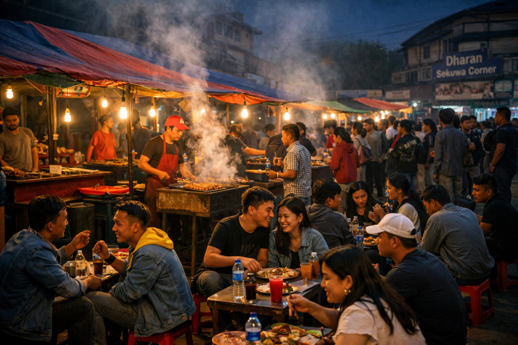
Walk into Dharan and something shifts. The flat Terai is behind you now, the road has been climbing through forest, and suddenly you’re in a city draped across a hillside, cooler, greener, with a pace that feels distinctly different from the plains below. Dharan is often called the gateway to eastern Nepal’s hills and mountains, and it wears that title with a certain pride.
The city has a fascinating multicultural identity. It was once home to a major British Gurkha recruitment centre, and that military heritage left its mark: orderly streets, a cantonment area, and a legacy of connection to the wider world that gives Dharan a cosmopolitan edge unusual for a city its size. Limbu, Rai, Magar, Gurung, Newar, and Madheshi communities all call Dharan home, and the cultural mix is reflected in everything from the food to the festivals to the music drifting out of tea shops.
The B.P. Koirala Institute of Health Sciences, one of Nepal’s top medical institutions, is based here, and the city has a young, educated population that gives it an energetic feel. The main bazaar area is compact and walkable, and the surrounding hills offer easy day hikes with views over the city and the Terai beyond.
Where to eat
Dharan’s food scene punches way above its weight. The city is famous across Nepal for its sekuwa (grilled marinated meat), served smoky and charred on a metal plate with beaten rice and fiery chilli chutney. Evening food streets come alive after dark, with stalls selling everything from Rai-style pork curry to momos to chatpate. Come hungry.
15. Nepalgunj: Gateway to the Wild West
Population: 164,444 | Area: 85.94 km² | Province: Lumbini
Nepalgunj is hot. Let’s get that out of the way first. This Terai city near the Indian border in mid-western Nepal can feel like an oven from April to September, with temperatures regularly climbing above 40°C. But Nepalgunj is also one of the most culturally fascinating and strategically important cities in Nepal, and if you’re heading to the remote west, you’ll almost certainly pass through.
The city is the main air hub for western Nepal. Flights to Jumla, Dolpo, Simikot, and the Karnali region depart from Nepalgunj’s small airport, making it the gateway to some of the most remote and spectacular landscapes on Earth. If you’re trekking to Rara Lake (Nepal’s largest lake, high in the Karnali hills), exploring the ancient kingdom of Dolpo, or heading to the Kailash-Mansarovar region, Nepalgunj is where your journey begins.
Culturally, Nepalgunj is a melting pot. Hindu and Muslim communities live side by side here, and the city has some of Nepal’s most vibrant mosques alongside its temples. The old bazaar area, especially around Birendra Chowk, is a sensory overload of the best kind: fabric shops in every colour imaginable, jewellery vendors, spice stalls where turmeric and cumin are scooped from enormous sacks, and food carts selling chana chaat, samosas, and thick lassi.
Bageshwari Temple, perched on a small hill at the edge of the city, is worth the short climb for the views and the atmosphere. And if you have a day, take an excursion to Bardiya National Park, about two hours’ drive away. Less crowded than Chitwan and just as rich in wildlife, Bardiya offers jungle walks, river rafting, and one of the best chances in Nepal to spot a wild Bengal tiger.
Don’t miss
The Nepalgunj bazaar at night, when the heat of the day breaks and the whole city comes outside. Tea stalls overflow, families stroll, and the sound of Bollywood music drifts from shops competing for attention. It’s a slice of South Asian urban life that’s completely irresistible.
All 15 Cities at a Glance
| # | City | Population (2021 Census) | Area (km²) | Province |
|---|---|---|---|---|
| 1 | Kathmandu | 862,400 | 49.45 | Bagmati |
| 2 | Pokhara | 513,504 | 464.24 | Gandaki |
| 3 | Bharatpur | 369,268 | 432.95 | Bagmati |
| 4 | Lalitpur (Patan) | 294,098 | 36.12 | Bagmati |
| 5 | Birgunj | 272,382 | 132.07 | Madhesh |
| 6 | Biratnagar | 243,927 | 77.00 | Koshi |
| 7 | Ghorahi | 200,530 | 522.21 | Lumbini |
| 8 | Dhangadhi | 198,792 | 261.75 | Sudurpashchim |
| 9 | Itahari | 197,241 | 93.78 | Koshi |
| 10 | Janakpur | 194,556 | 91.97 | Madhesh |
| 11 | Butwal | 194,335 | 101.61 | Lumbini |
| 12 | Hetauda | 193,576 | 261.59 | Bagmati |
| 13 | Tulsipur | 179,755 | 384.63 | Lumbini |
| 14 | Dharan | 166,531 | 192.32 | Koshi |
| 15 | Nepalgunj | 164,444 | 85.94 | Lumbini |
Source: National Population and Housing Census 2021, Central Bureau of Statistics, Nepal.
What These Fifteen Cities Tell You About Nepal
Look at that list one more time, and something beautiful emerges. Nepal isn’t just mountains. It’s ancient royal cities and sprawling Terai market towns. It’s art colonies and industrial corridors and border crossings that smell like species and fuels. It’s holy cities where mythology walks the streets and hill towns where a dozen cultures sit down to eat together.
The top five cities, Kathmandu through Birgunj, are where most visitors spend their time, and for good reason. But venture into that second tier, from Biratnagar to Nepalgunj, and you’ll find a Nepal that’s raw, real, and endlessly rewarding. These aren’t tourist cities. They are cities where people live, work, celebrate, and eat extraordinarily well. And they’ll welcome you with a warmth that catches you off guard every single time.
Your Nepal Story Starts Now
Here’s the truth about Nepal: the country is small enough to cross in a day but rich enough to explore for a lifetime. These fifteen cities are just the beginning, doorways into a country that will change the way you travel, the way you eat, and quite possibly the way you see the world.
So pick a city. Any city on this list. Read about it, dream about it, and then book that flight. Whether you start in the incense-filled lanes of Kathmandu, the lakeside calm of Pokhara, the jungle edges of Bharatpur, or the far-flung bazaars of Nepalgunj… Nepal is waiting for you. And trust me, it’s worth every step.
Related Posts
Stay Informed With the Latest & Most Important News
Previous Post
Next Post
Previous Post

Next Post
- Top 15 Biggest Cities in Nepal by Population: Walk With Me Through Urban Nepal
- Two Weeks in Nepal: How to Plan the Ultimate Trip Across the Roof of the World
- Pokhara Calling: Why Nepal’s Lakeside City Will Steal Your Heart (and When to Go)
- Beyond Dal Bhat: A Traveller’s Guide to the Foods of Nepal
- No More Solo Trekking: Everything You Need to Know About Nepal’s 2026 Trekking Rules